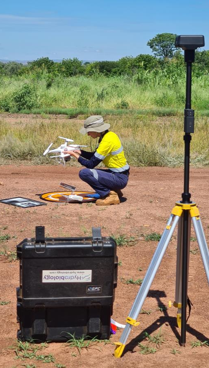

There’s a different perspective that comes with seeing the environment from above!
At Hydrobiology, our drone and UAV Capabilities help our clients access high-resolution environmental data that supports smarter planning, monitoring and decision-making across coastal, riverine, wetland and terrestrial environments.
Using RTK-enabled drone technology, multispectral imagery and advanced geospatial analysis, we deliver accurate 3D models, orthomosaics, digital surface models and vegetation health assessments that provide actionable insights for projects of all scales.
From habitat mapping and rehabilitation monitoring to water quality assessments, change detection and environmental impact studies, our UAV solutions help Clients understand complex environments with greater accuracy, efficiency and confidence.
With project experience spanning Australia, Singapore, Brazil and Southeast Asia, we’re proud to combine Environmental Science with cutting-edge technology to deliver practical outcomes for industry, government and resource sector clients.
Because better environmental decisions start with better data!
Are you ready to see your project from a different perspective? Get in touch with our Team to discover how our drone capabilities can support your next project!